
The Power of PostGIS for Spatial Analytics
How PostGIS turns PostgreSQL into a powerful geospatial database, enabling businesses and engineering teams to store, query, analyze, and visualize location data at scale—from logistics and retail to agriculture, smart cities, mobility, and real-time operations.
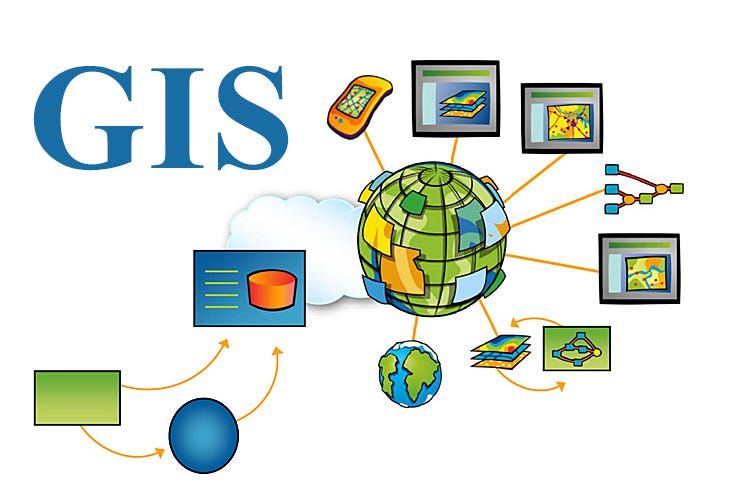


Article Contents
- •Why Location Data Matters
- •What Is PostGIS?
- •Why PostgreSQL + PostGIS Is So Powerful
- •Understanding Spatial Data
- •Spatial Queries That Unlock Business Insights
- •PostGIS for Logistics and Route Intelligence
- •Retail and Location Intelligence
- •Agriculture and Land Analytics
- •Smart Cities and IoT
- •Real-Time Spatial Analytics
- •Spatial Indexing and Performance
- •PostGIS vs. Specialized Geospatial Platforms
- •Common PostGIS Mistakes
- •A Practical Implementation Strategy
- •The Future of Spatial Analytics
- •Making the Call
- •Final Takeaway
How PostGIS turns PostgreSQL into a powerful geospatial database, enabling businesses and engineering teams to store, query, analyze, and visualize location data at scale—from logistics and retail to agriculture, smart cities, mobility, and real-time operations.
Why Location Data Matters
Location has become one of the most valuable dimensions of modern data.
Businesses increasingly need to understand not just what happened, but where it happened.
Consider questions such as:
Which customers live within 10 kilometers of a new store?
Which delivery vehicles are closest to an order?
Which farms are affected by a weather event?
Which properties are inside a flood-risk zone?
Which IoT devices are operating in a particular area?
These are spatial questions.
Traditional databases can store latitude and longitude as numbers:
latitude  = 19.0760
longitude = 72.8777
But storing coordinates is only the beginning.
The real value comes from being able to ask questions about distance, direction, boundaries, intersections, proximity, and geographic relationships.
That is where PostGIS becomes powerful.
What Is PostGIS?
PostGIS is a spatial extension for PostgreSQL that adds geospatial data types, functions, operators, and indexing capabilities.
Instead of treating location as two unrelated numbers:
latitude
longitude
PostGIS allows applications to work with geographic objects such as:
Points
Lines
Polygons
Multi-polygons
Geometry collections
A simplified architecture looks like:
                  PostgreSQL
                      │
                   PostGIS
                      │
       ┌──────────────┼──────────────┐
       ▼              ▼              ▼
     Points         Lines         Polygons
       │              │              │
       └──────────────┼──────────────┘
                      ▼
               Spatial Analytics
This means your application can perform geographic analysis directly inside the database.
Why PostgreSQL + PostGIS Is So Powerful
One of PostGIS's biggest advantages is that spatial data can live alongside conventional business data.
Imagine a delivery platform.
A standard database might contain:
orders
customers
drivers
payments
PostGIS can add:
customer_location
driver_location
delivery_zone
route
service_area
Now the application can combine business and geographic information in a single query.
For example:
Find all unassigned orders within five kilometers of available drivers.
Conceptually:
Orders
   +
Drivers
   +
Locations
   ↓
Spatial Query
   ↓
Potential Matches
This is much more powerful than exporting location data to a separate system for every analysis.
Understanding Spatial Data
There are three concepts developers should understand early.
Points
A point represents a specific location.
Examples:
Customer
Store
Vehicle
Sensor
Delivery address
       ●
     Point
Lines
Lines represent paths or linear features.
Examples:
Roads
Delivery routes
Railways
Pipelines
●────────────●
     Line
Polygons
Polygons represent areas.
Examples:
Countries
Cities
Delivery zones
Property boundaries
Agricultural fields
   ┌───────────┐
   │           │
   │  Polygon  │
   │           │
   └───────────┘
Once these objects are stored as spatial data, PostGIS can reason about their relationships.
Spatial Queries That Unlock Business Insights
This is where PostGIS becomes genuinely interesting.
Instead of asking only:
What is the customer's location?
you can ask:
Which customers are within this delivery area?
Or:
Which stores are closest to this customer?
Or:
Which properties intersect this development zone?
Spatial operations can answer questions involving:
Distance
Containment
Intersection
Overlap
Nearest neighbors
Geographic relationships
A conceptual query flow looks like:
Business Data
     +
Spatial Data
     ↓
PostGIS Query
     ↓
Geographic Relationship
     ↓
Business Insight
This allows location to become a first-class part of application logic.
PostGIS for Logistics and Route Intelligence
Logistics is one of the clearest PostGIS use cases.
A delivery company may have:
Orders
   │
   ├── Pickup Location
   ├── Delivery Location
   └── Delivery Window

Vehicles
   │
   ├── Current Location
   └── Capacity
PostGIS can help answer:
Which vehicles are close to a new delivery?
Which orders fall inside a driver's service area?
Which routes intersect a restricted zone?
A simplified workflow:
New Order
    ↓
Location
    ↓
Nearby Vehicles
    ↓
Capacity / Availability
    ↓
Assignment
This can support more intelligent dispatch systems.
For large-scale routing optimization, PostGIS can work alongside specialized routing and optimization systems rather than replacing them.
Retail and Location Intelligence
Retailers can use spatial analytics to understand markets.
Suppose a company wants to evaluate a potential new store.
It could analyze:
Existing stores
Customer locations
Population density
Competitor locations
Transportation access
Sales performance
A spatial model could look like:
Potential Store
      │
      ├── Nearby Customers
      ├── Competitors
      ├── Existing Stores
      ├── Roads
      └── Demographics
             ↓
       Location Analysis
             ↓
       Business Decision
Instead of asking only:
How many customers do we have?
business leaders can ask:
Where are our customers concentrated, and how does that relate to our existing footprint?
That difference can significantly improve location strategy.
Agriculture and Land Analytics
Agriculture is another field where spatial data is extremely valuable.
A farm can contain boundaries representing:
Fields
Irrigation zones
Soil areas
Crop regions
Equipment routes
PostGIS can combine these boundaries with other datasets.
For example:
Farm Boundary
      +
Weather Data
      +
Soil Data
      +
Satellite Data
      ↓
Spatial Analysis
      ↓
Field-Level Insight
A farming platform might determine:
Which fields fall inside an area affected by heavy rainfall?
Or:
Which crop zones are closest to a water source?
Or:
Which equipment routes intersect specific field boundaries?
PostGIS can provide the spatial foundation while specialized analytics or machine-learning systems process imagery and agricultural models.
Smart Cities and IoT
Modern cities generate enormous amounts of location-aware data.
Examples include:
Traffic sensors
Public transport
Parking systems
Air-quality monitors
Emergency services
Street infrastructure
Connected devices
A city platform might look like:
IoT Devices
     ↓
Location Data
     ↓
PostGIS
     ↓
Spatial Analytics
     ↓
City Operations
Consider traffic management.
Instead of simply knowing that a sensor reports congestion, spatial analytics can help determine:
Which roads are affected?

What infrastructure is nearby?

Which routes could be impacted next?

Which emergency services are within the area?
Location transforms individual sensor readings into a geographic view of the city.
Real-Time Spatial Analytics
Location data becomes even more valuable when it changes continuously.
Consider a fleet-tracking application:
Vehicle
   ↓
GPS Update
   ↓
Spatial Database
   ↓
Geospatial Query
   ↓
Dashboard / Alert
The system might detect:
Vehicle entering a restricted zone
Driver leaving an assigned route
Asset approaching a destination
Device entering a service area
Customer approaching a pickup location
However, not every real-time location workload should write every GPS update directly into a primary transactional database.
High-frequency tracking may benefit from:
Event streams
Time-series storage
Data aggregation
Specialized geospatial infrastructure
PostGIS can then be used where durable spatial querying and relational analysis provide the most value.
Spatial Indexing and Performance
Spatial queries can become expensive when datasets grow.
Imagine searching millions of geographic objects:
10 Million Locations
        ↓
Distance Query
        ↓
Millions of Comparisons
A spatial index can dramatically reduce the amount of data that needs to be examined.
Conceptually:
Spatial Dataset
      ↓
Spatial Index
      ↓
Candidate Locations
      ↓
Precise Spatial Filter
      ↓
Results
This becomes especially important for queries such as:
Nearby locations
Objects inside a boundary
Intersecting geometries
Nearest-neighbor searches
But indexing is not a magic solution.
Teams still need to understand:
Query patterns
Geometry complexity
Coordinate systems
Data distribution
Table size
Write frequency
Performance should be measured with realistic datasets.
PostGIS vs. Specialized Geospatial Platforms
PostGIS is powerful, but it is not automatically the right tool for every spatial workload.
A PostgreSQL + PostGIS architecture is particularly attractive when you need:
Relational data
Transactional consistency
Spatial queries
SQL-based analytics
Strong integration with existing PostgreSQL systems
But specialized systems may be better for certain workloads involving:
Massive-scale geospatial processing
High-frequency location streams
Large-scale map tile generation
Specialized spatial simulations
Advanced distributed analytics
The right architecture may therefore look like:
                    Application
                        │
             ┌──────────┼──────────┐
             ▼          ▼          ▼
          PostGIS    Data Lake   Stream Platform
             │          │          │
             └──────────┼──────────┘
                        ▼
                  Spatial Analytics
PostGIS does not need to be the only spatial technology in the architecture.
Common PostGIS Mistakes
Treating Coordinates as Plain Numbers
Latitude and longitude alone do not provide the spatial operations that applications often need.
Ignoring Coordinate Reference Systems
Different datasets can use different coordinate systems.
Incorrect assumptions can produce incorrect distances and spatial relationships.
Running Expensive Spatial Queries Without Indexes
Large datasets can quickly make unoptimized queries expensive.
Storing Excessively Detailed Geometries
Highly complex shapes can increase storage and query costs.
Use the appropriate level of geographic detail for the business requirement.
Using the Database for Every Real-Time GPS Update
High-frequency tracking workloads may require a dedicated ingestion and processing architecture.
Assuming PostGIS Replaces Routing Engines
Spatial databases can analyze geography, but advanced route optimization may require specialized algorithms and services.
Ignoring Data Quality
Incorrect coordinates, invalid geometries, and inconsistent boundaries can produce misleading analysis.
A Practical Implementation Strategy
Step 1: Identify the Business Questions
Start with questions such as:
What is nearby?
What is inside this area?
What intersects this boundary?
What is changing geographically?
Step 2: Classify Your Spatial Data
Identify:
Points
Lines
Polygons
Multi-geometries
Step 3: Choose Appropriate Coordinate Systems
Make sure all datasets are represented correctly for the analysis being performed.
Step 4: Design the Database
Combine spatial fields with the business attributes needed for analysis.
Step 5: Create Spatial Indexes
Index the geometry columns used by important queries.
Step 6: Build Representative Queries
Test:
Distance searches
Containment
Intersections
Nearest-neighbor queries
Step 7: Test With Realistic Scale
A spatial query that works with 10,000 records may behave very differently with 100 million.
Step 8: Separate Workloads When Necessary
Use streaming systems, caches, data warehouses, or specialized processing platforms where appropriate.
Step 9: Add Visualization
Connect PostGIS to:
Web maps
Dashboards
GIS tools
Operational interfaces
Step 10: Monitor Performance
Track:
Query latency
Index usage
Database load
Storage
Write throughput
Spatial query frequency
The Future of Spatial Analytics
Spatial analytics is becoming increasingly connected with AI, IoT, cloud infrastructure, and real-time data.
A modern architecture may look like:
                 Real World
                     │
            Sensors / Devices
                     │
                     ▼
                Data Platform
                     │
        ┌────────────┼────────────┐
        ▼            ▼            ▼
     PostGIS         AI        Analytics
        │            │            │
        └────────────┼────────────┘
                     ▼
              Spatial Intelligence
                     │
          ┌──────────┼──────────┐
          ▼          ▼          ▼
       Business    Operations   Users
AI can help identify patterns across spatial datasets.
IoT can provide continuously changing geographic information.
Satellite imagery can create richer environmental and agricultural datasets.
Cloud infrastructure can make large-scale spatial processing more accessible.
The result is a move from:
Where is it?
toward:
What is happening here, why is it happening, and what should we do next?
That is the real promise of spatial intelligence.
Making the Call
Engineering and data leaders considering PostGIS should ask:
Which business decisions depend on location?

Do we need spatial queries alongside relational business data?

What are our most common geographic queries?

How large will the spatial dataset become?

How frequently will location data change?

Do we need real-time processing or primarily analytical queries?

Which workloads belong in PostGIS, and which require specialized systems?

Have we designed indexes and coordinate systems correctly?

How will spatial results be visualized and consumed?
The goal is not to put every location-related workload into PostgreSQL.
It is to use PostGIS where relational and spatial intelligence naturally belong together.
Final Takeaway
Location data is no longer limited to maps.
It is becoming a fundamental part of modern decision-making.
PostGIS makes it possible to bring geographic intelligence directly into the database that already powers business applications.
Its strength comes from combining:
PostgreSQL's relational foundation
Powerful spatial operations
Spatial indexing
SQL-based analysis
Transactional data
Real-world business context
The evolution looks like:
Coordinates → Spatial Data → Spatial Queries → Location Intelligence → Spatial Decision-Making
A logistics company can understand proximity.
A retailer can evaluate markets.
An agricultural platform can analyze fields.
A city can understand infrastructure.
An IoT platform can interpret geographic events.
And businesses can connect all of this location intelligence with the operational data they already rely on.
The power of PostGIS is not simply that it knows where things are. It allows applications to understand the relationships between things in space.
That distinction opens the door to much richer applications.
Start with the business question.
Model geography deliberately.
Index for real workloads.
Keep high-frequency data pipelines appropriate to their workload.
And combine PostGIS with specialized systems when the problem demands it.
When location becomes part of the data model, geography stops being a map feature—and becomes a source of intelligence.
Frequently Asked Questions
Need a product built?
We build custom software, mobile apps, and web platforms for startups and enterprises.



Their team became an extension of ours — within months they'd rebuilt our entire product experience from the ground up.