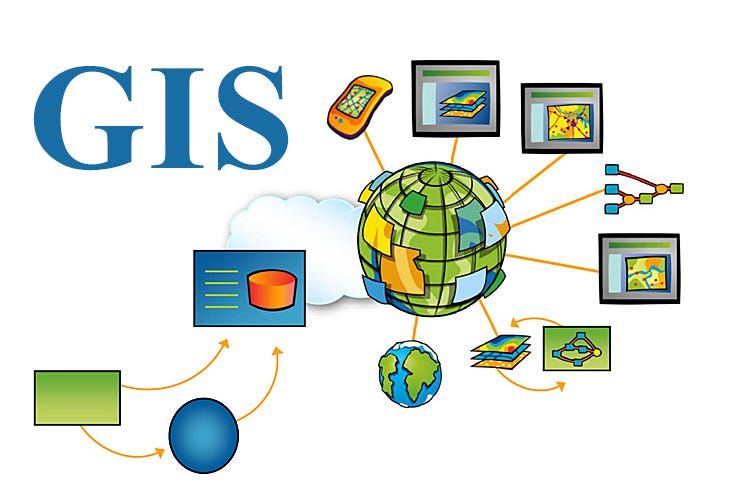
GIS DEVELOPMENT SERVICES
Work with GIS experts trusted by the world's top tech teams.
Our Geographic Information System (GIS) specialists have successfully delivered complex spatial platforms for governments, logistics, and enterprise clients. Work with vetted nearshore geospatial architects specializing in PostGIS, Mapbox, ESRI, and advanced spatial analytics.

AI CODING TOOLS WE USE




Get expert help for your
GIS project.
ENDORSED BY ENGINEERS. TRUSTED BY CTOS.





CUSTOM GIS DEVELOPMENT SERVICES
Advanced Spatial Engineering & Analytics
We architect and build software leveraging the full spectrum of geospatial technologies. From processing massive satellite raster data to rendering millions of vector points at 60fps in the browser, our engineers deliver unshakeable location intelligence platforms.


Our engineers consistently perform at the highest standard — the kind of excellence that turns clients into long-term partners.
The best partnerships are the ones you don't have to worry about. We deliver the kind of technical execution and reliability that builds long-term trust. It's why clients consistently praise our work quality and performance.
OUR GIS DEVELOPMENT TEAM






Why tech leaders choose our Geospatial engineers:
We provide seasoned GIS architects who deeply understand the mathematics of map projections (CRSs), topological rules, and spatial indexing. Our teams deliver location intelligence platforms that are accurate, performant, and highly secure.
GIS CASE STUDIES
Numbers of GIS projects delivered.
Our clients rely on us for GIS software that satisfies strict performance, security, and compliance targets. From high-volume payment gateways to HIPAA-aligned healthcare services, our GIS applications stay in production years after launch.
Looking for a team with this kind of
track record?
Tell us more about your GIS needs.
AI EXPERTS
Work with AI-augmented GIS developers.
Every developer we provide uses modern AI coding tools to ship faster than ever while producing cleaner, more consistent code.
 Claude Code
 GitHub Copilot
 Codex
Codex Cursor
 Replit
 Gemini
 Copilot
 Ollama
 Windsurf
TOOLS FOR GIS DEVELOPMENT
The ecosystem we use for GIS projects:
We deliver Geographic Information System (GIS) solutions using industry-leading spatial tools and mapping libraries. Our developers leverage robust geospatial databases, vector tile engines, and cloud-native raster pipelines to build highly interactive location intelligence platforms.
We architect highly performant databases capable of querying, joining, and analyzing complex geometric data at scale.
We build interactive, GPU-accelerated web maps tailored to your use case, visualizing massive spatial layers seamlessly.
We automate geoprocessing tasks and data transformations using robust backend geospatial libraries and Python scripts.
We deploy powerful mapping servers to distribute raw data as highly optimized vector and raster tiles to the web client.
We customize and extend industry-standard enterprise GIS suites, helping organizations manage their authoritative spatial data.
We build custom routing engines capable of calculating optimal paths based on custom road networks and restrictions.
We process remote sensing data and build scalable geospatial data lakes using cloud-native architectures.
We render complex 3D geospatial data, point clouds, and large-scale analytical overlays utilizing WebGL.
We architect highly performant databases capable of querying, joining, and analyzing complex geometric data at scale.
CLIENT TESTIMONIALS
Get GIS results you can stand behind.
Our work holds up in reviews, in production, and in front of the board.
Digital Commerce
Developed BitForge's Modern Digital Commerce Platform
"Finding engineers who could quickly understand our product vision and execute at a high level was our biggest challenge. RavenWright Systems consistently provided outstanding developers who became trusted contributors, helping us build BitForge into a reliable and scalable digital marketplace."
Digital Commerce
Developed BitForge's Modern Digital Commerce Platform
BitForge was created to provide a secure digital marketplace for buying and selling software products, digital assets, and downloadable content. Our engineers developed a scalable full-stack platform featuring secure authentication, role-based access control, payment processing, cloud storage integration, and an optimized user experience that supports reliable transactions and future platform growth.
HEALTHCARE
Healthcare & MedTech
"What stands out most about RavenWright Systems is the quality of its people. They consistently provide talented, experienced developers who quickly become trusted members of our team, helping us deliver reliable software on time and at a high standard."
Networking
Developed new Communication Platform
"RavenWright Systems helped us transform an ambitious idea into a successful product. Their ability to rapidly source experienced developers and seamlessly integrate them into our team allowed us to accelerate development without compromising on quality."
Networking
Developed new Communication Platform
A growing business needed a modern communication platform to connect teams and customers more efficiently. Our engineers designed scalable backend services, built real-time messaging capabilities, integrated secure APIs, and optimized the user experience to support rapid growth, high availability, and seamless collaboration.
Platform as a Service(Paas)
Scaled and Maintained Deployra's AWS Infrastructure
"RavenWright Systems has been an outstanding technology partner throughout our growth. Their engineers consistently delivered high-quality solutions, adapted quickly to evolving requirements, and helped us build a reliable deployment platform we're confident will scale with our business for years to come."
Join 50+ companies who count on our GIS developers
FLEXIBLE ENGAGEMENT MODELS
Need extra GIS expertise?
Plug us in where you need us most.
We customize every engagement to fit your workflow, priorities, and delivery needs.
STAFF AUGMENTATION
Extend Your Engineering Team with Senior Talent
DEDICATED TEAMS
Need a dedicated team to deliver products faster?
SOFTWARE OUTSOURCING
Need an experienced team to own your entire project?
Extend Your Engineering Team with Senior Talent
STAFF AUGMENTATION
Quickly scale your development capacity with experienced software engineers who integrate seamlessly into your existing team. They work within your processes, collaborate in your daily ceremonies, and deliver production-ready code from day one.
Need a dedicated team to deliver products faster?
DEDICATED TEAMS
Build a cross-functional engineering team tailored to your product goals. We assemble developers, designers, QA engineers, and project managers who take ownership of delivery, collaborate closely with your stakeholders, and drive projects from planning through production.
Need an experienced team to own your entire project?
SOFTWARE OUTSOURCING
Entrust your complete software development lifecycle to our experienced engineering teams. From discovery and architecture to development, testing, deployment, and ongoing support, we take full ownership while keeping you informed through every milestone.
Kick off GIS projects in 2 - 4 weeks.
We have reps
across the US.
Speak with a client engagement specialist near you.
Discuss solutions and decide team structure.
Tell us more about your needs. We'll discuss the best-fit solutions and team structure based on your success metrics, timeline, budget, and required skill sets.
Onboard your team and get to work.
With project specifications finalized, we select your team. We're able to onboard developers and assemble dedicated teams in 2-4 weeks after signature.
We track performance on an ongoing basis.
We continually monitor our teams' work to make sure they're meeting your quantity and quality of work standards at all times.
GIS FAQ
What tech leaders ask about GIS before pulling us in:
While the Google Maps API is excellent for basic consumer routing and placing simple markers, a custom GIS application is built for deep analytical power. GIS allows you to perform complex spatial queries (e.g., finding intersections between massive polygons), manage custom raster/vector data layers, analyze terrain, and visualize large enterprise datasets securely.
We are highly proficient in both ecosystems. For clients looking to minimize licensing costs, we architect robust open-source stacks utilizing PostGIS, GeoServer, and Mapbox. For enterprise clients heavily invested in ESRI, our developers build custom web apps, geoprocessing tools, and extensions utilizing ArcGIS Enterprise and the ArcGIS API for JavaScript.
Visualizing millions of points or complex polygons directly will freeze a browser. Our developers optimize this by generating Vector Tiles on the server (using tools like Tippecanoe or pg_tileserv). Vector tiles break massive spatial datasets into small, pre-computed chunks, allowing clients like Mapbox GL JS to render data smoothly at 60 FPS using the GPU.
Standard SQL databases only store numbers and text. PostGIS is an extension for PostgreSQL that adds true spatial data types (Geometries/Geographies) and spatial indexes (GiST). This allows the database to instantly answer complex mathematical questions like 'Which of our delivery trucks are currently inside this custom drawn polygon?' with immense speed.
Yes, this is a very common requirement. Shapefiles are a legacy format that is difficult to query and manage in a multi-user web environment. We use ETL tools like GDAL/OGR and Python to securely migrate your Shapefiles, GeoJSONs, or KMLs into a centralized spatial database like PostGIS, ensuring data integrity and enabling high-performance queries.
Absolutely. Instead of paying high per-transaction fees to commercial routing APIs, we build proprietary routing engines using tools like pgRouting and OSRM (Open Source Routing Machine) paired with OpenStreetMap data. This allows us to calculate optimal routes based on your company's custom restrictions (e.g., heavy truck weight limits on specific roads).
We utilize advanced raster processing libraries like GDAL and cloud-native architectures like Cloud Optimized GeoTIFFs (COG). For complex environmental analysis over time, we integrate with platforms like Google Earth Engine to process massive multispectral satellite datasets without needing to download terabytes of imagery locally.
For highly customized, vector-based, and 3D map rendering, we highly recommend Mapbox GL JS (or open-source alternatives like MapLibre). For simpler 2D mapping needs that require immense flexibility, Leaflet is an excellent, lightweight open-source choice. For heavy 3D data visualizations, we utilize Deck.gl.